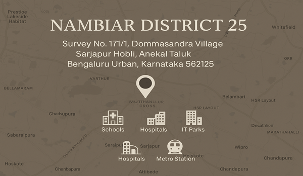
Nambiar District 25 Directions

The Nambiar District 25 in Sarjapur is exceptionally well-connected to many parts of Bangalore through major roads and efficient transportation. Located in a prime region of East Bangalore off Sarjapur Road, it offers easy access to the city's top IT hubs and industrial areas. Residents benefit from quick routes to primary roads and tech parks.
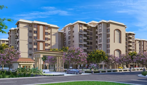
Knowing how to reach your new home and its surrounding facilities is important. Directions to Nambiar District 25 Bangalore are clearly updated on Google Maps, offering precise routes and distances from various city points. This ensures a comfortable travel experience with good public transport options. Nambiar District 25 Sarjapur Road, developed by Nambiar Builders, provides easy access to all essential amenities nearby, helping residents lead a peaceful and convenient life.
How to Reach Nambiar District 25: Your Travel Guide
Nambiar District 25 Muthanallur Cross is located at Muthanallur Cross, Sarjapur Road, East Bangalore, built on over 100 acres of prime land. This area boasts advanced public infrastructure and facilities, with easy access to major National Highways (NH), connecting roads, and upcoming metro stations.
Traveling by Road (Private Vehicle/Taxi):
- From Kempegowda International Airport (BLR): Approximately 49-50 km, reachable in about 1 hr 30 mins to 1 hr 45 mins via NH 44 and Whitefield-Hoskote Road, or connecting to Sarjapur Road via the Outer Ring Road.
- From Bangalore City Railway Station (Majestic): Approximately 31 km, taking about 1 hr 40 mins via Sarjapur-Marathahalli Road.
- From Electronic City: Around 15.5 km, typically 38 mins via Husukur Road.
- From Whitefield: Approximately 15 km, reachable in 1 hr 15 min via SH 35 or Sarjapur-Whitefield Main Road.
- From M G Road (Central Bangalore): About 24 km, taking around 1 hr 40 mins via Sarjapur-Marathahalli Road.
- From Koramangala: Approximately 18 km, reachable in 45 mins via Ambalipura - Sarjapur Road.
- From HSR Layout: Around 17 km, taking 40 mins via the 100 feet Outer Ring Road (ORR).
- From Bellandur: Approximately 15 km, reachable in 38 mins via Bellandur Main Road.
- From Varthur: About 11 km, taking 25 mins via Varthur Sarjapur Road.
- From Yeshwanthpur: Approximately 42.3 km, reachable in 1 hr 34 mins via Outer Ring Road.
By Public Transport:
- BMTC Buses: Bangalore Metropolitan Transport Corporation (BMTC) operates extensive services along Sarjapur Road. Key bus stops near the project include Kodathi Gate Bus Stop (4 km or 8 mins away).
- Airport Buses (Vayu Vajra): Direct Volvo bus services (e.g., KIAS routes) connect Kempegowda International Airport to various points on Sarjapur Road, providing a convenient option for air travelers.
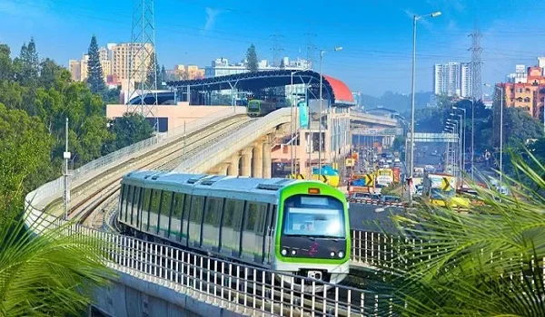
- Namma Metro (Upcoming): The Blue Line of Namma Metro is currently under construction and will significantly boost connectivity. The nearest upcoming metro stations include Bommasandra Metro Station (12 km or 23 mins away) and Hebbagodi Metro Station (14 km or 25 mins away). Once operational, these will offer rapid transit to the city.
- Railway Stations: Heelalige Railway Station is approximately 9 km or 17 mins from the project, offering easy access for visitors and travelers from other parts of the state. Bellandur Railway Station is also in proximity.
Key Facilities & Landmarks Nearby:
- Hotels:
- Octave Hotel & Spa: 9.8 km or 22 mins
- Hospitals & Healthcare:
- Manipal Hospital: 10.7 km or 24 mins
- Cloudnine Hospital: 9.2 km or 21 mins
- Natus Women & Children Hospital: 6 km
- Narayana Clinic: 8 km
- IT & Business Parks:
- Prestige Group Tech Park: 16.5 km or 44 mins
- Mind Comp Tech Park: 19 km or 43 mins
- Kalyani Tech Park: 11.8 km or 33 mins
- RMZ Ecoworld: 11 km or 30 mins
- ITPL: 17 km or 46 mins
- Shopping & Entertainment:
- Central Mall: 11 km or 26 mins
- Market Square Mall: 9.9 km or 21 mins
- Forum The Prestige City: 5 km
- Schools & Education:
- Deens Academy: 8.7 km or 20 mins
- Holy Cross School: 15.4 km or 38 mins
- New Oxford School: 10 km or 23 mins
- Ryan International Academy, Sarjapur Road: 2.4 km
- Delhi Public School, Bangalore East: 2.3 km
- Harvest International School: 3.5 km
- Greenwood High: 5.7 km
- St Jeromes PU and Degree College: 4.9 km
- Bangalore College of Engineering and Technology: 9 km
Using Navigation Apps:
For the most accurate and real-time directions considering current traffic, we highly recommend using GPS navigation apps like Google Maps. Simply search for "Nambiar District 25" to get precise routes from your exact location.